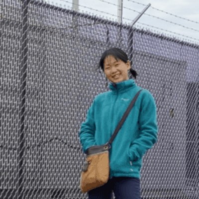
Mariko Oue
· Research ProfessorVerifiedStony Brook University · Sustainability Studies
Active 2004–2026
About
Mariko Oue is a professor at Stony Brook University and serves as a Principal Investigator in the Office of the Dean SOMAS. Her research activity is centered on Earth and Planetary Sciences, with a focus on atmospheric and cloud microphysics, land–aerosol–cloud interactions, and atmospheric radiation. She has contributed to studies involving radar tracking, ice microphysics, turbulence in Arctic cloud systems, and the characterization of convection using various radar and satellite data. Her work includes collaboration on projects supported by the US Department of Energy and the National Science Foundation, investigating convective cloud characteristics, snow sensitivity to clouds, and land–aerosol–cloud interactions in the southeastern US. Oue has authored numerous peer-reviewed articles and conference contributions, advancing understanding of atmospheric processes through observational and modeling studies.
Research topics
- Computer Science
- Environmental science
- Geography
- Meteorology
- Geology
- Climatology
- Remote sensing
Selected publications
Monthly Weather Review · 2026-03-30
articleAbstract A Ka-Band Scanning Polarimetric Radar (KASPR) at Stony Brook University on Long Island, New York (NY), is used to investigate shear and turbulent layers in winter precipitation events, which are often revealed as Doppler spectrum width (SW) layers (SWLs). This study provides the first climatology of SWLs in winter precipitation events from 2017 to 2021 by documenting their spatial and kinematic characteristics. Three events are presented to introduce these structures in different winter precipitation environments. A percentile-based detection algorithm was developed to automatically identify SWLs in plan position indicator (PPI) scans, and a velocity–azimuth display (VAD) technique is applied to decompose the flow into resolved and unresolved components, from which proxies for shear and turbulence are derived. A binary operator is used to conjoin SW enhancements exceeding the 75th percentile into individual SWLs. The algorithm identified 77 955 SWLs in KASPR PPI scans over four winter seasons. Most SWLs are thin (<200 m) and occur preferentially between 0.6 and 0.9 of cloud depth. SWL magnitudes are generally weak but occasionally exceed 3 m s −1 , and azimuthal spans are typically narrow (<90°). Resolved shear is most closely associated with SWLs, while unresolved velocity (turbulence proxy) is not preferentially concentrated within SWLs. However, when a shear-organized SWL is present, unresolved velocity exerts the primary control on its thickness and magnitude, with resolved shear playing a secondary role. Given the ubiquitous nature of these SWLs, they may be important features for understanding subkilometer-scale dynamic processes in winter precipitation. Significance Statement This study presents the first climatology of Doppler spectrum width layers (SWLs) within northeast U.S. winter precipitation events using high-resolution Ka-band radar data. A percentile-based detection algorithm identified over 77 000 SWLs, allowing documentation of their spatial and kinematic characteristics. SWLs are found to be predominantly thin and weak features that occur most often in the mid–upper portions of clouds. Their thickness and magnitude are primarily driven by turbulence, with shear exerting a secondary influence. These results enhance our understanding of fine-scale dynamical processes in winter precipitation.
A radar view of ice microphysics and turbulence in Arctic cloud systems
Atmospheric chemistry and physics · 2025-11-24
articleOpen accessCorrespondingAbstract. Ice microphysical processes are inherently complex because of their sensitivity to temperature and humidity, the diversity of ice crystal habits, and their interaction with supercooled liquid water (SCL) and turbulence. Long-term surface-based radar observations have been systematically used to unravel the different processes that affect ice particle growth. In this study, we present a statistical analysis of 6.5 years of Ka-band radar observations in Arctic cloud systems, combined with thermodynamic profiles derived from radiosonde measurements. For the first time, ice particle growth and sublimation – diagnosed from vertical gradients of radar reflectivity and mean Doppler velocity – are systematically mapped across a broad range of temperature and moisture conditions. These vertical gradients correspond closely to saturation levels relative to ice and exhibit a strong temperature dependence in supersaturated regions. Notably, distinct signatures near −15 °C are indicative of dendritic growth. Turbulence, quantified via the eddy dissipation rate (EDR), is most frequently observed in regions containing SCL. The co-occurrence of SCL and elevated turbulence results in significantly enhanced ice particle growth compared to conditions in which either is present alone. This work provides new observational constraints that are critical for improving the representation of ice microphysics in atmospheric models.
2025-01-17 · 1 citations
preprintBulletin of the American Meteorological Society · 2025-11-04
articleAbstract The U.S. Department of Energy (DOE) Atmospheric Radiation Measurement (ARM) user facility has established a new site in the Bankhead National Forest (BNF) in northern Alabama that will gather data on how clouds, the land surface, and aerosols interact at a hierarchy of scales important to understanding and simulating the Earth system. Starting its operations in October 2024, the BNF site provides a multiyear opportunity for scientists to unravel complex land–atmosphere interactions. A suite of ground-based sensors, elevated tower-based instrumentation, and aerial facilities will enable scientists to investigate those interactions from within the canopy to the clouds. The southeastern United States was recommended by the DOE ARM and its collaborators in the broader community as an important region to address their common scientific questions, given the region’s abundant surface-forced convective clouds and mesoscale convective systems that pose ongoing challenges in Earth system models. The region is also home to significant terrain complexity and land-use heterogeneity that will unleash new understanding of anthropogenic and biogenic aerosol processes, boundary layer aerosol–cloud interactions, and the interactions between the terrestrial ecosystem and coupled aerosol–cloud–radiation processes.
2025-02-25
preprintOpen accessAbstract. Vertically pointing millimeter-wavelength radars provide a wealth of information about cloud and precipitation particle properties. Doppler spectral data can inform on how particles of varying vertical velocities contribute to total backscattered power observed. It is more computationally cost effective to process moment data instead of spectra data, but doing so leaves valuable information on the cutting room floor. To confidently identify a multi-modal spectra event, in which two or more modes are present within a layer, Doppler spectral data are essential. This means long-term identification of layers featuring multi-modal spectra can be cost prohibitive. To address this, we explore three multi-modal spectra cases from winter precipitation events to determine characteristic signatures of these layers in the moment data averaged over short time periods (~145 s) and explore how these layers differ from the rest of the vertical profiles. We find that the mean spectrum width and the standard deviation of mean Doppler velocity can be used to determine whether or not a layer is multi-modal. In particular, multi-modal layers in mixed-phase and ice clouds feature larger mean spectrum width (exceeding 0.19 m s-1) and smaller standard deviation of the mean Doppler velocity (below 0.1 m s-1). In Part 1 of this study, the identification criteria and methods are described. In Part 2, we perform a verification of the method for three years of vertically pointing radar data, and explore the meteorological conditions associated with identified multi-modal spectral events.
Studying Aerosol, Clouds, and Air Quality in the Coastal Urban Environment of Southeastern Texas
Bulletin of the American Meteorological Society · 2025-08-04 · 3 citations
articleAbstract A multi-agency succession of field campaigns was conducted in southeastern Texas during July 2021 through October 2022 to study the complex interactions of aerosols, clouds and air pollution in the coastal urban environment. As part of the Tracking Aerosol Convection interactions Experiment (TRACER), the TRACER- Air Quality (TAQ) campaign the Experiment of Sea Breeze Convection, Aerosols, Precipitation and Environment (ESCAPE) and the Convective Cloud Urban Boundary Layer Experiment (CUBE), a combination of ground-based supersites and mobile laboratories, shipborne measurements and aircraft-based instrumentation were deployed. These diverse platforms collected high-resolution data to characterize the aerosol microphysics and chemistry, cloud and precipitation micro- and macro-physical properties, environmental thermodynamics and air quality-relevant constituents that are being used in follow-on analysis and modeling activities. We present the overall deployment setups, a summary of the campaign conditions and a sampling of early research results related to: (a) aerosol precursors in the urban environment, (b) influences of local meteorology on air pollution, (c) detailed observations of the sea breeze circulation, (d) retrieved supersaturation in convective updrafts, (e) characterizing the convective updraft lifecycle, (f) variability in lightning characteristics of convective storms and (g) urban influences on surface energy fluxes. The work concludes with discussion of future research activities highlighted by the TRACER model-intercomparison project to explore the representation of aerosol-convective interactions in high-resolution simulations.
Atmospheric chemistry and physics · 2025-09-09
articleOpen accessAbstract. Winter storms can cause disruptions in the densely populated regions of the northeastern United States. Mesoscale snow bands embedded within winter storms are often the main focus of snowfall forecasts and analyses. While primary bands are associated with frontogenesis, multi-bands are found in environments with both frontogenesis and frontolysis. This study investigates the relationship between observed surface snowfall rates and local enhancements in radar reflectivity (i.e., mesoscale snow bands) using data from 264 storm days over 11 winter seasons (2012–2023). We compare hourly surface snowfall rates obtained by National Weather Service (NWS) Automated Surface Observing Systems (ASOS) weather stations with the area × time fractions of locally enhanced reflectivity features and of all echoes passing over the 25 km radius of the surface observation. Our analysis focuses on non-orographic snowstorms with surface winds < 5 m s−1. Our findings show that most of the time snow rates are low (75 % of hours had liquid-equivalent snow rates less than 1 mm h−1). Heavy snow rates (>2.5 mm h−1 liquid equivalent) are rare (<4 % of observations). When enhanced reflectivity features pass over a location, only 1 out of 4 h have heavy surface snow rates. High-spatial-resolution vertical cross-sections from airborne radar obtained during the NASA Microphysics and Precipitation for Atlantic Coast-Threatening Snowstorms (IMPACTS) field campaign and rapid-update range-height indicators (RHIs) from ground-based radar demonstrate that enhanced reflectivity features in snow aloft are tilted and smeared on their way to the surface as their constituent snow particles are dispersed laterally by the horizontal winds within the storm. The duration of all snow echo over a location is useful in determining where higher snowfall accumulations may occur.
A radar view of ice microphysics and turbulence in Arctic stratiform cloud systems
2025-05-28
preprintOpen accessCorrespondingAbstract. Ice microphysical processes are inherently complex because of their sensitivity to temperature and humidity, the diversity of ice crystal habits, and their interaction with supercooled liquid water (SCL) and turbulence. Long-term surface-based radar observations have been systematically used to unravel the different processes that affect ice particle growth. In this study, we present a statistical analysis of 6.5 years of Ka-band radar observations, combined with thermodynamic profiles derived from radiosonde measurements. For the first time, ice particle growth and sublimation—diagnosed from vertical gradients of radar reflectivity and mean Doppler velocity—are systematically mapped across a broad range of temperature and moisture conditions. These vertical gradients correspond closely with saturation levels relative to ice and exhibit a strong temperature dependence in supersaturated regions. Notably, distinct signatures near -15 °C are indicative of dendritic growth. Turbulence, quantified via the eddy dissipation rate (EDR), is most frequently observed in regions containing SCL. When SCL is located near cloud base, it often appears decoupled from high EDR values, suggesting that latent heat release from SCL alone is insufficient to generate strong turbulence. Instead, the presence of turbulence appears to actively support the formation and maintenance of SCL. The co-occurrence of SCL and elevated turbulence results in significantly enhanced ice particle growth compared to conditions in which either is present alone. This work provides new observational constraints that are critical for improving the representation of ice microphysics in atmospheric models.
Rapid SACR Observations of Convection at Bankhead National Forest (RAPID) Field Campaign Report
2025-11-01
reportOpen access1st authorCorresponding2025-01-17 · 1 citations
preprintOpen accessCorrespondingAbstract. Winter storms can cause significant societal impacts in the densely-populated regions of the Northeast United States. Mesoscale snow bands embedded within winter storms are often the main focus of snowfall forecasts and analyses. This study investigates the relationship between observed surface snowfall rates and local enhancements in radar reflectivity (i.e. mesoscale snow bands) using data from 264 storm days over 11 winter seasons (2012–2023). We compare hourly surface snowfall rates obtained by ASOS weather stations with the area × time fractions of locally-enhanced reflectivity features and of all echo passing over the 25 km radius vicinity of the surface observation. Our analysis focuses on non-orographic snow storms with surface winds < 5 m s−1. Our findings show that most of the time snow rates are low (75 % of hours had liquid equivalent snow rates less than 1 mm hr−1). Heavy snow rates (> 2.5 mm hr−1 liquid equivalent) are rare (< 4 % of observations). When enhanced reflectivity features pass over a location, only 1 out of 4 hours have heavy surface snow rates. High spatial resolution vertical cross sections from airborne radar obtained during the NASA IMPACTS field campaign and rapid update RHIs from ground-based radar demonstrate that enhanced reflectivity features in snow aloft usually lack the vertical column continuity characteristic of reflectivity structures in rain. Ice streamers with higher reflectivities are tilted and smeared on their way to the surface as their constituent snow particles are dispersed laterally by the horizontal winds within the storm.
Frequent coauthors
- 315 shared
Pavlos Kollias
Stony Brook University
- 152 shared
Greg M. McFarquhar
- 145 shared
Ann M. Fridlind
Goddard Institute for Space Studies
- 144 shared
Maximilian Maahn
Leipzig University
- 144 shared
Dmitri Moisseev
University of Helsinki
- 144 shared
Virendra P. Ghate
Argonne National Laboratory
- 144 shared
Susanne Crewell
University of Cologne
- 144 shared
Christopher R. Williams
- Resume-aware match score
- Save to shortlist
- AI-drafted outreach
See your match with Mariko Oue
PhdFit ranks faculty by your research interests, methods, and publications — grounded in their actual work, not templates.
- Free to start
- No credit card
- 30-second signup