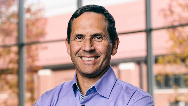
Daniel G. Aliaga
VerifiedPurdue University · Computer Science
Active 1991–2026
About
Daniel G. Aliaga is an Associate Professor of Computer Science at Purdue University, who joined the department in Fall 2003. His research focuses on urban visual computing, integrating computer graphics, computer vision, and artificial intelligence to facilitate semi-automatic and controllable content creation and editing of large and complex geometric models for applications in digital simulation, visualization, entertainment, education, and cultural heritage. He is a pioneer of inverse procedural modeling for urban spaces, having introduced this topic in his early work around 2005/2007. His goal is to convert unstructured data into organized, easily editable representations, enabling the inference of modeling rules and parameters from various data sources such as 3D models, sketches, images, point clouds, and urban features. Dr. Aliaga has collaborated with experts across multiple disciplines including urban planning, atmospheric sciences, civil engineering, architecture, hydrology, and transportation engineering to capture, simulate, and modify urban environment models. His work also involves developing novel image processing and 3D reconstruction methods, including high-accuracy self-calibrating 3D reconstruction techniques and methods for embedding signatures into 3D surfaces for counterfeiting detection. Throughout his career, he has published extensively, contributed to international conferences, and received funding from organizations such as NSF, IARPA, USDA, Google, Microsoft, and Adobe. His research aims to improve urban ecosystems and support sustainable urban design through advanced modeling, simulation, and visualization tools.
Research topics
- Computer science
- Artificial intelligence
- Computer vision
- Computer graphics (images)
- Human–computer interaction
Selected publications
AI-based urban layout generation model
npj Urban Sustainability · 2026-04-04
articleOpen accessSenior authorBuilding Instance Segmentation for Dense Urban Settlements
Proceedings of the AAAI Conference on Artificial Intelligence · 2026-03-14
articleOpen accessSenior authorAbout 25% of the world’s population live in informal urban settlements containing densely packed buildings (approximately 8,000 houses per square-km) which do not lend themselves favorably to state-of-the-art satellite-based building segmentation methods due to, for example, occlusion, vegetation, shadows and low resolution. To address these challenges, we introduce a novel instance segmentation and counting approach for dense buildings. Our system first extracts a conservative set of tentative building center points using a deep network for jumpstarting a Segment Anything Model 2 (SAM2) module to produce an initial over-segmentation. Second, we use a graph neural network to refine the over-segmented regions into polygons representing accurate building masks. Experiments show that our approach achieves higher accuracy in instance segmentation and counting especially in challenging densely packed building areas in Brazil, Mexico, India, Pakistan, and Kenya, for instance.
Where Are the City Trees? Monitoring Urban Trees across the U.S. Using Generative AI
Communications of the ACM · 2026-03-30
articleOpen accessSenior authorFinding where the trees are in a city and monitoring any changes are essential for sustainable urban management. Historically, urban forests are mainly inventoried via manual processes often limited to public lands. Leveraging advances in computing, we present a novel generative artificial intelligence (AI) method along with a first-ever national-scale dataset, to automatically localize trees in cities across the nation using satellite imagery. Our monitoring approach is fully automated and can be completed for 330 U.S. cities within less than a day of computing, enabling actionable knowledge of changes in urban trees and supporting sustainable development decisions. We successfully localized and counted over 278 million trees, achieving an average tree count accuracy of 92.5% and spatial accuracy of 1.5m for 2024–2025. Our computational approach allows for novel nationwide analysis to be performed. For example, we can localize approximately 117 million trees on private lands and 161 million on public lands. Further, we show and quantify that urban tree distribution exhibits strong spatial disparity, with low-income communities having substantially fewer trees and less canopy cover than others. In addition, we compare tree count and layouts before and after multiple major events (e.g., major fires and destructive weather phenomena). Overall, our approach enhances computational urban planning, including weather and extreme event forecasting, for the development of sustainable cities.
Self-Supervised Large Scale Point Cloud Completion for Archaeological Site Restoration
ArXiv.org · 2025-03-06
preprintOpen accessSenior authorPoint cloud completion helps restore partial incomplete point clouds suffering occlusions. Current self-supervised methods fail to give high fidelity completion for large objects with missing surfaces and unbalanced distribution of available points. In this paper, we present a novel method for restoring large-scale point clouds with limited and imbalanced ground-truth. Using rough boundary annotations for a region of interest, we project the original point clouds into a multiple-center-of-projection (MCOP) image, where fragments are projected to images of 5 channels (RGB, depth, and rotation). Completion of the original point cloud is reduced to inpainting the missing pixels in the MCOP images. Due to lack of complete structures and an unbalanced distribution of existing parts, we develop a self-supervised scheme which learns to infill the MCOP image with points resembling existing "complete" patches. Special losses are applied to further enhance the regularity and consistency of completed MCOP images, which is mapped back to 3D to form final restoration. Extensive experiments demonstrate the superiority of our method in completing 600+ incomplete and unbalanced archaeological structures in Peru.
UNC Libraries · 2025-08-13
articleOpen accessWUDAPT, an International community generated urban canopy information and modeling infrastructure (Portal) to facilitate urban focused climate, weather, air quality, and energy use modeling application studies.
Self-Supervised Large Scale Point Cloud Completion for Archaeological Site Restoration
2025-06-10 · 2 citations
articleSenior authorPoint cloud completion helps restore partial incomplete point clouds suffering occlusions. Current self-supervised methods fail to give high fidelity completion for large objects with missing surfaces and unbalanced distribution of available points. In this paper, we present a novel method for restoring large-scale point clouds with limited and unbalanced ground-truth. Using rough boundary annotations for a region of interest, we project the original point clouds into a multiple-center-of-projection (MCOP) image, where fragments are projected to images of 5 channels (RGB, depth, and rotation). Completion of the original point cloud is reduced to inpainting the missing pixels in the MCOP images. Due to lack of complete structures and an unbalanced distribution of existing parts, we develop a self-supervised scheme which learns to infill the MCOP image with points resembling existing "complete" patches. Special losses are applied to further enhance the regularity and consistency of completed MCOP images, which is mapped back to 3D to form final restoration. Extensive experiments demonstrate the superiority of our method in completing 600+ incomplete and unbalanced archaeological structures in Peru.
MMIG-Bench: Towards Comprehensive and Explainable Evaluation of Multi-Modal Image Generation Models
ArXiv.org · 2025-05-26
preprintOpen accessRecent multimodal image generators such as GPT-4o, Gemini 2.0 Flash, and Gemini 2.5 Pro excel at following complex instructions, editing images and maintaining concept consistency. However, they are still evaluated by disjoint toolkits: text-to-image (T2I) benchmarks that lacks multi-modal conditioning, and customized image generation benchmarks that overlook compositional semantics and common knowledge. We propose MMIG-Bench, a comprehensive Multi-Modal Image Generation Benchmark that unifies these tasks by pairing 4,850 richly annotated text prompts with 1,750 multi-view reference images across 380 subjects, spanning humans, animals, objects, and artistic styles. MMIG-Bench is equipped with a three-level evaluation framework: (1) low-level metrics for visual artifacts and identity preservation of objects; (2) novel Aspect Matching Score (AMS): a VQA-based mid-level metric that delivers fine-grained prompt-image alignment and shows strong correlation with human judgments; and (3) high-level metrics for aesthetics and human preference. Using MMIG-Bench, we benchmark 17 state-of-the-art models, including Gemini 2.5 Pro, FLUX, DreamBooth, and IP-Adapter, and validate our metrics with 32k human ratings, yielding in-depth insights into architecture and data design.
COHO: Context-Sensitive City-Scale Hierarchical Urban Layout Generation
Lecture notes in computer science · 2024-10-25 · 8 citations
book-chapterSenior authorComputational Urban Science · 2024-03-12 · 5 citations
articleOpen access1st authorCorrespondingAbstract Due to their importance in weather and climate assessments, there is significant interest to represent cities in numerical prediction models. However, getting high resolution multi-faceted data about a city has been a challenge. Further, even when the data were available the integration into a model is even more of a challenge due to the parametric needs, and the data volumes. Further, even if this is achieved, the cities themselves continually evolve rendering the data obsolete, thus necessitating a fast and repeatable data capture mechanism. We have shown that by using AI/graphics community advances we can create a seamless opportunity for high resolution models. Instead of assuming every physical and behavioral detail is sensed, a generative and procedural approach seeks to computationally infer a fully detailed 3D fit-for-purpose model of an urban space. We present a perspective building on recent success results of this generative approach applied to urban design and planning at different scales, for different components of the urban landscape, and related applications. The opportunities now possible with such a generative model for urban modeling open a wide range of opportunities as this becomes mainstream.
Lag Camera: A Moving Multi-Camera Array for Scene-Acquisition
2024-11-27 · 2 citations
articleOpen access1st authorCorrespondingMany applications, such as telepresence, virtual reality, and interactive walkthroughs, require a three-dimensional(3D)model of real-world environments. Methods, such as lightfields, geometric reconstruction and computer vision use cameras to acquire visual samples of the environment and construct a model. Unfortunately, obtaining models of real-world locations is a challenging task. In particular, important environments are often actively in use, containing moving objects, such as people entering and leaving the scene. The methods previously listed have difficulty in capturing the color and structure of the environment while in the presence of moving and temporary occluders. We describe a class of cameras called lag cameras. The main concept is to generalize a camera to take samples over space and time. Such a camera, can easily and interactively detect moving objects while continuously moving through the environment. Moreover, since both the lag camera and occluder are moving, the scene behind the occluder is captured by the lag camera even from viewpoints where the occluder lies in between the lag camera and the hidden scene. We demonstrate an implementation of a lag camera, complete with analysis and captured environments.
Recent grants
III: Medium: Collaborative Research: Deep Generative Modeling for Urban and Archaeological Recovery
NSF · $830k · 2021–2026
CDS&E: STRONG Cities - Simulation Technologies for the Realization of Next Generation Cities
NSF · $552k · 2012–2017
NSF · $600k · 2019–2024
NSF · $500k · 2009–2013
MSPA-MCS: 3D Scene Digitization - A Novel Invariant Approach for Large-Scale Environment Capture
NSF · $506k · 2004–2008
Frequent coauthors
- 27 shared
Bedřich Beneš
Purdue University West Lafayette
- 25 shared
Dev Niyogi
The University of Texas at Austin
- 18 shared
Gen Nishida
Purdue University System
- 18 shared
Pratiman Patel
National University of Singapore
- 15 shared
Carlos A. Vanegas
University of Sucre
- 14 shared
Yi Xu
- 12 shared
Ignacio Garcia‐Dorado
Google (United States)
- 12 shared
Jacques Teller
Education
- 1998
PhD, Computer Science
UNC Chapel Hill
- Resume-aware match score
- Save to shortlist
- AI-drafted outreach
See your match with Daniel G. Aliaga
PhdFit ranks faculty by your research interests, methods, and publications — grounded in their actual work, not templates.
- Free to start
- No credit card
- 30-second signup