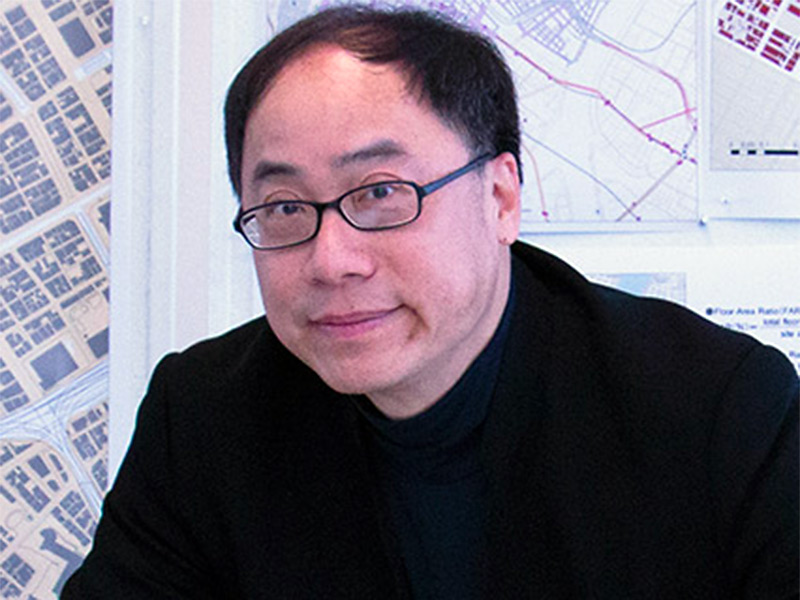
Perry Pei-Ju Yang
· Professor of City & Regional Planning and ArchitectureVerifiedGeorgia Institute of Technology · City and Regional Planning
Active 2004–2025
About
Perry Pei-Ju Yang is a Professor of City and Regional Planning and Architecture at the Georgia Institute of Technology, where he also serves as the Director of the Eco Urban Lab. His work focuses on integrating data analytics into urban design to enhance the ecological and energy performance of cities. Yang has published extensively in this area, including over fifty articles and book chapters since 2009, and he co-edited the book 'Urban Systems Design: Creating Sustainable Smart Cities in the Internet of Things Era' in 2020. He has also contributed to a 2019 theme issue in the journal Environment and Planning B: Urban Analytics and City Science, exploring new research agendas and applications of emerging technologies in urban design within the smart city movement. Yang's urban design projects have received international recognition, with awards in competitions since 2005, including a project featured by CNN as an eco-friendly venue. His recent design work includes projects shortlisted for the 2022 Asian Games Village in Hangzhou, the Musi River Revitalization in Hyderabad, and water town designs in China’s Yangtze River Delta. He has been actively involved in smart city projects in Japan, including collaborations with the University of Tokyo, Keio University, and the Global Carbon Project. Yang has held visiting positions at the University of Tokyo and Cambridge University, and he served as the Bayer Chair Professor at Tongji University. His academic career includes a Fulbright Scholarship and a stint as an Assistant Professor at the National University of Singapore. His teaching interests encompass urban design courses that focus on smart urban systems, ecological design, and urban engineering systems, emphasizing resilience, sustainability, and social inclusiveness in future cities.
Research topics
- Computer Science
- Engineering
- Civil engineering
- Systems engineering
- Architectural engineering
- Computer Security
- Environmental science
- Knowledge management
- Mathematics
- Software engineering
- Data science
- Process management
- Geography
- Statistics
Selected publications
Transportation Research Record Journal of the Transportation Research Board · 2025-11-07
articleSenior authorAirports are critical connectivity infrastructure that support regional mobility flows and elevate cities’ positions within an interconnected global network. However, airports can also act as mobility barriers, encouraging carcentric developments that hinder locals from reaching nonairport destinations. We use Hartsfield-Jackson Atlanta International Airport (H-JAIA) and the AeroATL Greenway Plan (the Greenway)—a newly proposed trail plan in the Atlanta aerotropolis region—as a comparative case study to explore contrasting roles of network flow infrastructure. We quantified the barrier effect of H-JAIA on biking and walking trips using a distance-based metric (the ratio of Euclidean to modeled travel distance), evaluated the Greenway’s potential impact through scenario modeling with origin–destination flow data from a regional activity-based model, and developed a public-facing web tool that allows users to select any origin and destination pair on a map and view how the Greenway would alter trip routing and experience. Our results provided evidence that H-JAIA and its surrounding environment impede local mobility flows. The Greenway had a stronger impact on enhancing trip experience than on reducing travel distance, though the specific effects varied by segment and implementation scenario. These findings were validated in a participatory modeling workshop, where community stakeholders explored the tool and provided feedback based on their lived experiences. This integration of narrative framing, data-driven methods, and interactive engagement helped strengthen community trust and build momentum for future Greenway implementation.
Environment and Planning B Urban Analytics and City Science · 2025-02-04 · 5 citations
articleSenior authorCorrespondingRecognizing the critical role of cities in mitigating greenhouse gas emissions, many cities are adopting carbon neutrality goals as part of their climate action strategies. The efficacy of these initiatives, however, has been undermined by complexity of systemic problems, ineffectiveness in planning implementation, and lack of stakeholder engagement. Urban and community-level carbon reduction should transcend urban design and systems optimization to incorporate multi-faceted dimensions in urban contexts. To address these challenges, this paper proposes a framework of urban digital twins that includes digital representation, performance modeling, design interventions and interactive platform for decisions over temporal processes. The CANVAS, or Carbon Neutrality Architecting New Visions for Architectural Systems, is a systems architecting approach to modeling the process of urban revitalization for achieving carbon neutrality by 2050. The developed workflow integrates multidisciplinary approaches for carbon mapping, gap identification, alternative generation, Urban Building Energy Modeling (UBEM) simulation, evaluation, and decision-making to demonstrates applicability of the proposed framework through a case study of the Nihonbashi district in Tokyo. The approach revealed that Energy Use Intensity (EUI) can be decreased by 99 kWh/m 2 /y through reconstruction and operational improvements. Emerging photovoltaic technologies can further cut EUI by an average of 42.5 kWh/m 2 /y, although results vary significantly in respect to building characteristics, particularly geometry and floor area. The incremental, cyclical systems architecting approach revealed that a 97% reduction in carbon emissions could be achieved by the seventh cycle through stakeholder-centric system interventions. This paper contributes to the development of urban digital twin methodologies by integrating systems architecting concepts with UBEM as transformative tools for carbon neutral urban design and development.
The international archives of the photogrammetry, remote sensing and spatial information sciences/International archives of the photogrammetry, remote sensing and spatial information sciences · 2025-09-19
articleOpen accessSenior authorAbstract. Nihonbashi in Tokyo is a high-density urban environment that faces increasing risks of disaster such as heatwaves, yet current disaster management plans lack dynamic, real-time response mechanisms to address uneven vulnerability across neighborhoods. This study enhances Nihonbashi’s urban heat resilience using urban digital twins, a dynamic virtual replica integrating real-time data to simulate and optimize urban systems. Employing a 4-step scenario planning model (descriptive, evaluative, predictive, prescriptive), it integrates real-time heat risk, resilience hub occupancy, and social demographic data to optimize access to cool spaces and transportation routes. Leveraging open-sources tools like Network X, OSMnx, and Getis-Ord Gi*, the framework identifies high-risk zones such as office headquarters and subway stations to identify vulnerability hotspots and simulates urban network performance during heatwaves. A heat scenario classifier achieves 96.7% accuracy in predicting heat risk levels. Built on ArcGIS Experience Builder, the platform enables dynamic rerouting to less occupied shelters and shaded pedestrian pathways, prioritizing vulnerable populations, particularly the elderly. Unique contributions include real-time data integration, high-accuracy heat prediction, and an equity-focused approach, distinguishing it from static GIS-based simulations. Data from OpenStreetMap, PLATEAU, and e-Stat ensure reliability, although real-time data access poses challenges. Stakeholders, including planners, emergency responders, and residents, can engage via the interactive platform to simulate scenarios and enhance resilience. This scalable, open-source framework offers a transformative model for urban heat management adaptable to other cities.
The international archives of the photogrammetry, remote sensing and spatial information sciences/International archives of the photogrammetry, remote sensing and spatial information sciences · 2025-09-19 · 1 citations
articleOpen accessSenior authorAbstract. This study presents a data-driven framework for transforming high-density urban districts toward carbon neutrality through the integration of Generative Design (GD), Multi-Objective Optimization (MOO), and interactive Urban Digital Twins. Using Tokyo’s Nihonbashi District as a case study, the research addresses the challenge of retrofitting 154 existing buildings under spatial and regulatory constraints. Buildings are categorized into three retrofit strategies—Reconstruction, Renovation, and Maintenance—based on structural condition, building age, and energy performance. The proposed methodology consists of a three-stage process: (1) baseline performance assessment using Urban Building Energy Modeling (UBEM), (2) design generation and evaluation of alternative design scenarios via parametric modeling and optimization across four key criteria (Resilience, Energy Performance, Financial Feasibility, and Social Impact), and (3) real-time scenario exploration through an interactive digital twin’s interface. Additional modeling layers include occupancy analytics and renewable energy simulations. Results indicate that coordinated redevelopment and hybrid energy strategies could achieve significant reductions in energy use intensity (up to 99 kWh/m2/year) and support on-site generation (up to 42.5 kWh/m2/year). The framework provides a scalable approach for carbon-neutral urban regeneration that balances technical, environmental, and human-centered goals.
2024-10-31
preprintOpen accessSenior authorToyosu, a waterfront urban development on the reclaimed land of Tokyo Bay, faces issues such as a lack of walkability and high heat vulnerability.The main objective of this research is to leverage Digital Twins technology to enhance multimodal transportation system resilience, equity, and connectivity, utilizing the problem of heat on Toyosu of Tokyo as a case study.The research questions include: 1) What are the key variables (e.g., urban design, infrastructure, human) for designing a resilience hub? 2) Considering these key variables, how do we leverage emerging tools (e.g., Digital Twins systems) to inform planning and decision-making to reduce pedestrian vulnerability to heat?This study proposes a proof-of-concept Digital Twin Interface (DTI) utilizing geographic information system (GIS), agentbased modeling (ABM), and digital urban design modeling tools (Rhino/Grasshopper).Two scenarios were constructed to simulate the thermal comfort of Toyosu in 2023 and in 2030, demonstrating the potential for urban form to impact pedestrian comfort.The output of these simulations is integrated within the DTI to inform pedestrian decision making during high heat events.This study informs the design of resilience hubs broadly and is applied to the case of heat stress in Toyosu as a proof-of-concept.The variables impacting walkability, multimodal connectivity, and transportation
2024-01-23
preprintOpen accessSenior authorThis paper addresses the imperative goal of achieving carbon neutrality in Tokyo's historic Nihonbashi district by 2050.The proposal of a systems design model based on the reconstruction and renovation of the existing built environment through design changes enables meeting the goals of net-zero emissions targets.Our study proposes the integration of 3D modeling techniques and scenarios generation for complex urban neighborhood systems and explores design decisions aimed at further reducing carbon emissions.By leveraging advanced technologies, such as digital urban modeling tools (building energy modeling and design generation based on Rhino 3D, Grasshopper, Ladybug, Climate Studio, and ArcGIS) as well as systems architecting tools (including morphological matrix, alternative concepts analysis, and model-based systems engineering, MBSE), we seek to provide a comprehensive framework for decision-makers and urban planners to assess the environmental impact of design choices.Our approach involves developing a digital representation of the Nihonbashi district, incorporating various architectural and environmental parameters.Through simulation, we analyze the potential carbon reduction benefits of alternative design interventions, including the following variables: materiality (structure), building density, building type/use, façade, and renewable energy integration.The findings of our research highlight the potential for significant carbon emission reductions through innovative design decisions.By quantifying the environmental impact of various design scenarios, decision-makers can make informed choices that align with the district's carbon neutrality objectives.Additionally, our study investigates the economic viability and feasibility, as well as the equitable impacts of implementing these design changes, considering factors such as cost, construction logistics, and stakeholder involvement.This paper contributes to the existing body of knowledge related to planning decision support systems by exploring the role of digital modeling as a transformative tool of urban planning for carbon neutrality.By emphasizing the importance of incorporating design changes to address carbon emissions, we aim to provide actionable insights for urban development in Nihonbashi and inspire similar initiatives worldwide.
Systems-level Methodology for Optimizing Urban Infrastructure Energy Resilience
2024-10-31 · 1 citations
preprintOpen accessSenior authorSSRN Electronic Journal · 2024-01-01
preprintOpen accessSenior authorDrones · 2024-11-19 · 10 citations
articleOpen accessIn recent years, the rapid growth of e-commerce and on-demand delivery services has placed a significant strain on urban logistics systems. Technological advances such as unmanned aerial vehicle (UAV)-based logistics systems have thus emerged as promising solutions in urban environments and are increasingly being piloted worldwide. However, the implementation of UAV logistics risks exacerbating social inequities, particularly in marginalized communities that may disproportionately bear the noise and safety risks. To mitigate these risks, it is crucial to integrate social equity considerations into urban UAV logistics. This study explores social equity factors through a systematic literature review and social media analysis of Xiaohongshu (the Little Red Book), a popular Chinese social media platform known for its extensive user base and active discussions on social issues. This literature review involves a full-text examination, while latent Dirichlet allocation (LDA) topic modeling is used to analyze social media comment datasets. Each method identifies social equity factors and separately assesses their relative importance, resulting in the final identification of 24 key factors that provide a holistic view of public sentiment and academic discourse. The findings reveal a divide between academic concerns around systemic risks and a public focus on immediate needs. By synthesizing these insights, this study provides a social equity landscape for urban UAV logistics and actionable references for policymakers and stakeholders.
Urban Airspace Route Planning for Advanced Air Mobility Operations
The urban book series · 2023-01-01 · 2 citations
book-chapter
Frequent coauthors
- 95 shared
Steven Jige Quan
Seoul National University
- 31 shared
Yihan Wu
West China Hospital of Sichuan University
- 28 shared
Michael B. Tobey
National Institute for Environmental Studies
- 21 shared
Yoshiki Yamagata
- 16 shared
Florina Dutt
Georgia Institute of Technology
- 14 shared
Soowon Chang
Purdue University West Lafayette
- 13 shared
Zhikai Peng
Delft University of Technology
- 13 shared
Daniel Castro‐Lacouture
Purdue University West Lafayette
Awards & honors
- 3rd Prize, International Competition of Macao-Hengqin Cooper…
- 3rd Prize, Water Town International Urban Design Competition…
- Finalist, Future Shanshui City; Dwellings in Lishui Mountain…
- Fulbright Scholarship (1999-2000)
- Bayer Chair Professor, UN Environment- Tongji Institute of E…
- Resume-aware match score
- Save to shortlist
- AI-drafted outreach
See your match with Perry Pei-Ju Yang
PhdFit ranks faculty by your research interests, methods, and publications — grounded in their actual work, not templates.
- Free to start
- No credit card
- 30-second signup