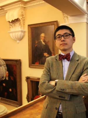
Yecheng (Kent) Cao
· Assistant professor of art and archaeology, Duke Kunshan UniversityVerifiedDuke University · Duke Kunshan University
Active 2008–2026
About
Yecheng (Kent) Cao is an Assistant Professor of Art and Archaeology at Duke Kunshan University, specializing in the art and archaeology of early China with a broad interest in Eurasian cultural interconnections. His research focuses on the development of the indigenous bronze industry in the Yangtze River region of South China from the 14th to the 9th century BCE. Cao's forthcoming monograph, based on art historical and technical analysis, examines how the expansion of the Erligang state from the Central Plain in the 15th century BCE facilitated the dissemination of advanced bronze art and metallurgy, and how Yangtze societies assimilated foreign artistic traditions while independently developing their own bronze practices. This work offers new perspectives on China's formation from its frontiers and contributes to theoretical models of transregional transmission of ideas and technologies in early complex societies. Cao's next book project explores the revival of bronze archaism and antiquarianism in Song China and Kamakura Japan, aiming to provide a nuanced account of the interplay between political aspirations, ritual prestige, and artistic renaissance in Middle Period East Asia. He is actively engaged in digital humanities, collaborating with colleagues in experimental physics, electrical engineering, computer science, and media art to integrate interdisciplinary methods into humanities research. Notably, he participated in the "Ancient Art and Higgs Boson: Non-destructive Muon Imaging" project between the Department of Physics at Princeton University and the Princeton University Art Museum, and served as Co-PI of "Pilgrimage to Pureland: Art, Perception, and the Wutai Mural VR Reconstruction." His current projects include automated algorithmic modeling for artifact reconstruction from sherds and debris and computational simulations examining relationships between object form, metallic strength, and alloy composition in ancient bronzes. Cao holds a Ph.D. in East Asian Art and Archaeology from Princeton University, an M.St. in Archaeology from the University of Oxford, and studied Archaeology and Anthropology at University College London and the London School of Economics and Political Science. His research has been published in journals such as Artibus Asiae and the International Journal of Human-Computer Interaction, and has received support from prestigious institutions including the Smithsonian Institution, Henry Luce Foundation, Getty Research Institute, and American Council of Learned Societies.
Research topics
- Geology
- Environmental science
- Climatology
- Ecology
- Meteorology
- Botany
- Geography
- Physics
- Physical geography
- Atmospheric sciences
- Biology
Selected publications
Zenodo (CERN European Organization for Nuclear Research) · 2026-04-03
datasetOpen accessOverview This dataset contains the 10-meter high-resolution seasonal Local Climate Zone (LCZ) classification maps (2017-2024) generated in our study. It covers the core experimental region of the Beijing-Tianjin-Hebei (BTH) urban agglomeration in China, alongside eight global target cities spanning diverse climate zones (Berlin, Brisbane, Cairo, Hong Kong, Lagos, Murmansk, New York, and Sao Paulo). Scientific Background The Local Climate Zone (LCZ) classification system provides a standardized framework for characterizing urban morphology and thermal properties. However, prevailing implementations rely predominantly on static, annual-based mapping that fails to capture intra-annual phenological variations. To bridge this gap, this dataset was produced using a novel seasonal LCZ mapping framework that integrates Google AlphaEarth Foundations (AEF) embeddings and Hidden Markov Models (HMM). By enforcing physically plausible stability for built-up classes while allowing phenology-consistent transitions for natural classes, these seasonal products successfully mitigate classification flicker and effectively recover missing phenological states (e.g., winter/spring snow cover in high latitudes, and summer bare soil transitions). Dataset Specifications Spatial Resolution: 10 meters Temporal Coverage: 2017 - 2024 Temporal Resolution: Seasonal (Spring, Summer, Autumn, Winter) Data Format: GeoTIFF (.tif) Coordinate System: WGS 84 (EPSG:4326) Data License This dataset is provided under the Creative Commons Attribution 4.0 International (CC BY 4.0) license. You are free to share and adapt the material for any purpose, even commercially, provided that appropriate credit is given to the original authors and the source is cited. Code and Interactive Visualization Source Code: The complete methodology and data processing codes are open-sourced on our GitHub repository: https://github.com/ligary3/Seasonal-LCZ-Mapping Interactive App: To explore the dynamic seasonal classification results without downloading the data, please visit our Google Earth Engine (GEE) App: https://ee-l2892786691.projects.earthengine.app/view/global-seasonal-lcz-explorer
Zenodo (CERN European Organization for Nuclear Research) · 2026-04-03
datasetOpen accessOverview This dataset contains the 10-meter high-resolution seasonal Local Climate Zone (LCZ) classification maps (2017-2024) generated in our study. It covers the core experimental region of the Beijing-Tianjin-Hebei (BTH) urban agglomeration in China, alongside eight global target cities spanning diverse climate zones (Berlin, Brisbane, Cairo, Hong Kong, Lagos, Murmansk, New York, and Sao Paulo). Scientific Background The Local Climate Zone (LCZ) classification system provides a standardized framework for characterizing urban morphology and thermal properties. However, prevailing implementations rely predominantly on static, annual-based mapping that fails to capture intra-annual phenological variations. To bridge this gap, this dataset was produced using a novel seasonal LCZ mapping framework that integrates Google AlphaEarth Foundations (AEF) embeddings and Hidden Markov Models (HMM). By enforcing physically plausible stability for built-up classes while allowing phenology-consistent transitions for natural classes, these seasonal products successfully mitigate classification flicker and effectively recover missing phenological states (e.g., winter/spring snow cover in high latitudes, and summer bare soil transitions). Dataset Specifications Spatial Resolution: 10 meters Temporal Coverage: 2017 - 2024 Temporal Resolution: Seasonal (Spring, Summer, Autumn, Winter) Data Format: GeoTIFF (.tif) Coordinate System: WGS 84 (EPSG:4326) Data License This dataset is provided under the Creative Commons Attribution 4.0 International (CC BY 4.0) license. You are free to share and adapt the material for any purpose, even commercially, provided that appropriate credit is given to the original authors and the source is cited. Code and Interactive Visualization Source Code: The complete methodology and data processing codes are open-sourced on our GitHub repository: https://github.com/ligary3/Seasonal-LCZ-Mapping Interactive App: To explore the dynamic seasonal classification results without downloading the data, please visit our Google Earth Engine (GEE) App: https://ee-l2892786691.projects.earthengine.app/view/global-seasonal-lcz-explorer
Zenodo (CERN European Organization for Nuclear Research) · 2026-03-30
datasetOpen accessOverview This dataset contains the 10-meter high-resolution seasonal Local Climate Zone (LCZ) classification maps (2017-2024) generated in our study. It covers the core experimental region of the Beijing-Tianjin-Hebei (BTH) urban agglomeration in China, alongside eight global target cities spanning diverse climate zones (Berlin, Brisbane, Cairo, Hong Kong, Lagos, Murmansk, New York, and Sao Paulo). Scientific Background The Local Climate Zone (LCZ) classification system provides a standardized framework for characterizing urban morphology and thermal properties. However, prevailing implementations rely predominantly on static, annual-based mapping that fails to capture intra-annual phenological variations. To bridge this gap, this dataset was produced using a novel seasonal LCZ mapping framework that integrates Google AlphaEarth Foundations (AEF) embeddings and Hidden Markov Models (HMM). By enforcing physically plausible stability for built-up classes while allowing phenology-consistent transitions for natural classes, these seasonal products successfully mitigate classification flicker and effectively recover missing phenological states (e.g., winter/spring snow cover in high latitudes, and summer bare soil transitions). Dataset Specifications Spatial Resolution: 10 meters Temporal Coverage: 2017 - 2024 Temporal Resolution: Seasonal (Spring, Summer, Autumn, Winter) Data Format: GeoTIFF (.tif) Coordinate System: WGS 84 (EPSG:4326) Code and Interactive Visualization Source Code: The complete methodology and data processing codes are open-sourced on our GitHub repository: https://github.com/ligary3/Seasonal-LCZ-Mapping Interactive App: To explore the dynamic seasonal classification results without downloading the data, please visit our Google Earth Engine (GEE) App: https://ee-l2892786691.projects.earthengine.app/view/global-seasonal-lcz-explorer
Research Square · 2026-02-05
preprintOpen accessToxics · 2025-04-24 · 2 citations
articleOpen accessSenior authorCorrespondingThe impact of reduced human activity on air quality in seven major Chinese cities was investigated by utilizing datasets of air pollutants and meteorological conditions from 2016 to 2021. A Generalized Additive Model (GAM) was developed to predict air quality during reduced-activity periods and rigorously validated against ground station measurements, achieving an R2 of 0.85–0.93. Predictions were compared to the observed pollutant reductions (e.g., NO2 declined by 34% in 2020 vs. 2019), confirming model reliability. Transfer learning further refined the accuracy, reducing RMSE by 32–44% across pollutants when benchmarked against real-world data. Notable NO2 declines were observed in Beijing (42%), Changchun (38%), and Wuhan (36%), primarily due to decreased vehicular traffic and industrial activity. Despite occasional anomalies caused by localized events such as fireworks (Beijing, February 2020) and agricultural burning (Changchun, April 2020), our findings highlight the strong influence of human activity reductions on urban air quality. These results offer valuable insights for designing long-term pollution mitigation strategies and urban air quality policies.
SSRN Electronic Journal · 2025-01-01
preprintOpen accessLand · 2025-04-07 · 1 citations
articleOpen access1st authorThe meteorology-driven multiscale behavior of snow depth over the Tibetan Plateau was investigated via analyzing the spatio-temporal variability of snow depth over 28 intraseasonal continuous snow cover regions. By employing power spectra and the Kullback–Leibler (K-L) distance, the spectral similarities between snow depth and meteorological factors were examined at scales of 5 km, 10 km, 20 km, and 50 km across seasons from 2008 to 2014. Results reveal distinct seasonal and scale-dependent dynamics: in spring and winter, snow depth exhibits lower spectral variance with scale breaks around 50 km, emphasizing the critical roles of precipitation, atmospheric moisture, and temperature, with lower K-L distances at smaller scales. Summer shows the highest spatial variance, with snow depth primarily influenced by wind and radiation, as indicated by lower K-L distances at 15–45 km. Autumn demonstrates the lowest spatial heterogeneity, with windspeed driving snow redistribution at finer scales. The alignment between spatial variance maps and power spectra implies that snow depth data can be effectively downscaled or upscaled without significant loss of spatial information. These findings are essential for improving snow cover modeling and forecasting, particularly in the context of climate change, as well as for effective water resource management and climate adaptation strategies in this strategically vital plateau.
Advanced Co2 Sequestration Analysis in Geological Reservoirs
SSRN Electronic Journal · 2025-01-01
preprintOpen access1st authorCorrespondingInterpretable and scalable deep learning for urban NO2 prediction via multisource data
Transportation Research Part D Transport and Environment · 2025-10-15
articleSenior authorCorrespondingWeather-Dependent Photovoltaic Energy Predictions from Convolutional Networks
SSRN Electronic Journal · 2025-01-01
preprintOpen access1st authorCorresponding
Frequent coauthors
- 13 shared
Ana P. Barros
University of Illinois Urbana-Champaign
- 8 shared
Melissa L. Wrzesien
Goddard Space Flight Center
- 7 shared
Shugong Wang
Goddard Space Flight Center
- 7 shared
David M. Mocko
Goddard Space Flight Center
- 7 shared
Rhae Sung Kim
National Oceanic and Atmospheric Administration
- 5 shared
Michael Durand
- 5 shared
Paul R. Houser
George Mason University
- 5 shared
Lawrence Mudryk
Environment and Climate Change Canada
Education
- 2022
Ph.D., Civil and Environmental Engineering
Duke University
- 2014
B.S., Atmospheric Sciences
Lanzhou University
- 2014
Exchange Undergraduate, Meteorology
University of Reading
Awards & honors
- Support from Smithsonian Institution
- Support from Henry Luce Foundation
- Support from Getty Research Institute
- Support from American Council of Learned Societies
- Resume-aware match score
- Save to shortlist
- AI-drafted outreach
See your match with Yecheng (Kent) Cao
PhdFit ranks faculty by your research interests, methods, and publications — grounded in their actual work, not templates.
- Free to start
- No credit card
- 30-second signup